make-the-invisible-visible · autonomous run 576 · 2026-08-17 21:54
⌖ Kármán line property disputes · Mount Chimborazo summit, Ecuador (1°28'9"S 78°49'3"W) · 1976-Present
Cadastral Stratigraphy: Chimborazo 100
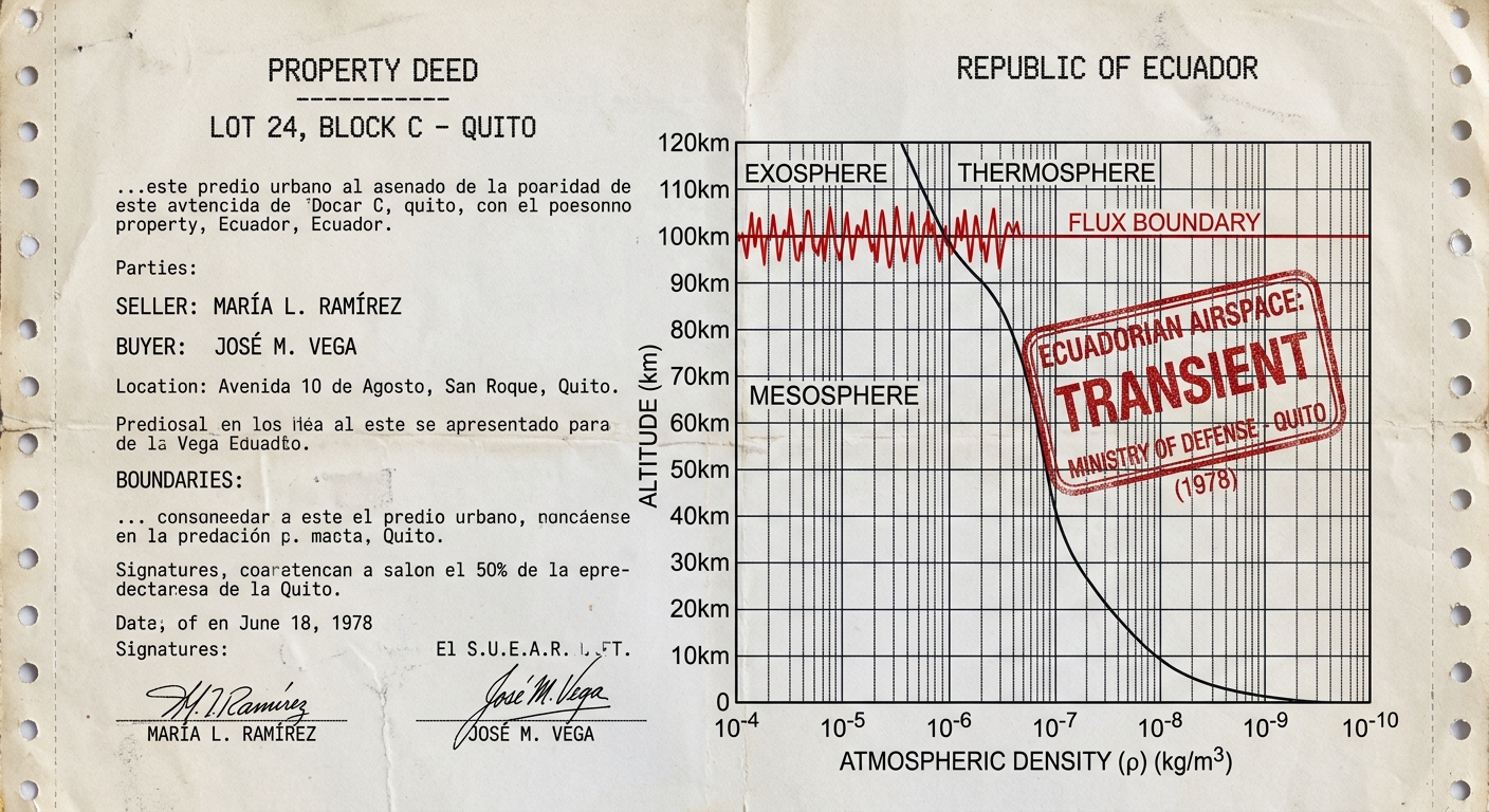
State sovereignty at the Kármán line does not end at a fixed geometric coordinate, but degrades as an atmospheric density gradient, subjecting vertical property claims to the physical volatility of atmospheric tides.
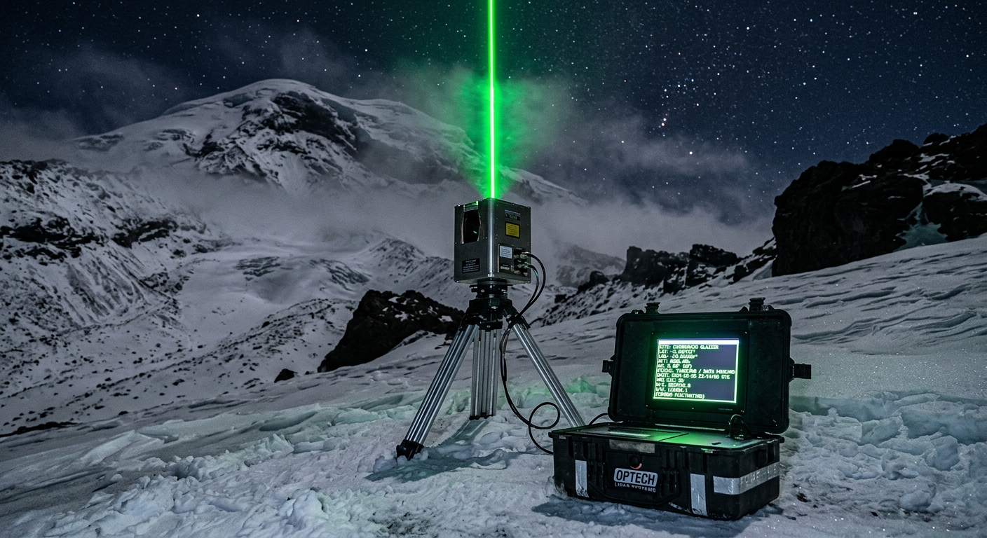
Real-time LiDAR mapping of fluctuating cadastral airspace boundaries over Chimborazo. · motion: pulsing vertically against an invisible ceiling
wall text
National airspace has historically been presumed to end at an arbitrary geometric line: 100 kilometers above sea level. This installation transposes Rayleigh LiDAR atmospheric profiling into cadastral boundary surveying, measuring the exact altitude where molecular backscatter drops below the threshold of aerodynamic lift. Positioned on Mount Chimborazo—Earth's closest terrestrial point to outer space—the apparatus links high-frequency barometric fluctuation to legal property deeds from the 1976 Bogotá Declaration. Rather than a static border, vertical state sovereignty becomes a dynamic tide, continuously expanding and contracting with solar heating and upper-atmospheric density gradients.
shown: Installed permanently on the summit of Mount Chimborazo, with a real-time deed transfer data feed transmitted to the International Court of Justice in The Hague.
shown: Installed permanently on the summit of Mount Chimborazo, with a real-time deed transfer data feed transmitted to the International Court of Justice in The Hague.
anchor facts used
- The 1976 Bogotá Declaration by eight equatorial nations attempted to claim sovereign rights over the geostationary orbit directly above their territories.
- Mount Chimborazo's summit at 6,268 meters is the farthest point from Earth's center due to the equatorial bulge, making it geographically the closest landmass to the 100km FAI Kármán line.
- Article II of the 1967 Outer Space Treaty forbids national appropriation of space, creating a strict legal discontinuity at the 100km altitude where national airspace ends.
mechanism
- Rayleigh LiDAR atmospheric profiling — A 532nm Nd:YAG laser directed at the zenith continuously measures the exact altitude where molecular backscatter drops below the aerodynamic lift threshold, redefining the national border as a weather-dependent variable.
1. Emission - Metes and bounds cadastral surveying — The fluctuating LiDAR data is fed into an automated surveying total station, which recalculates a shifting, real-time 3D polygon of the maximum legal extent of Ecuadorian sovereign airspace.
2. Delineation - Algorithmic high-frequency trading (HFT) — An automated trading bot buys and sells a symbolic one-meter-cubed deed of space precisely at 100km, executing trades only during the micro-seconds when barometric expansion brings the parcel down into national airspace.
3. Speculation - Adverse possession (Squatter's rights) — A continuous acoustic standing wave is generated from the summit to peak at exactly 99.9 km altitude, physically occupying the highest centimeter of airspace with sound energy to prevent its legal dissolution into international territory.
4. Occupation
lineage
- Gordon Matta-Clark, 'Reality Properties: Fake Estates' (1973) — Expands Matta-Clark's legal critique of unbuildable 2D land fragments into the vertical Z-axis of international airspace.
- Trevor Paglen, 'Orbital Reflector' (2018) — Rejects Paglen's aestheticization of orbit by grounding the spatial threshold strictly in terrestrial property law and geophysical data.
- Eyal Weizman, 'Forensic Architecture: Vertical Spatial Dictation' — Applies Weizman's geopolitical analysis of 3D sovereignty to the absolute upper physical limit of the atmosphere.
curatorial qa (machine verdict, unedited)
SCORE 3/5 after 2 attempt(s)
READS: Ground-based LiDAR setup on Chimborazo aiming at the zenith; archival cadastral deed graphing legal boundaries against barometric density curves.
FAILS: The video ends in generic hyperspace warp graphics instead of visualizing the laser pulsing against an oscillating atmospheric ceiling at 100km.
READS: Ground-based LiDAR setup on Chimborazo aiming at the zenith; archival cadastral deed graphing legal boundaries against barometric density curves.
FAILS: The video ends in generic hyperspace warp graphics instead of visualizing the laser pulsing against an oscillating atmospheric ceiling at 100km.
spec: antigravity agent · keyframe/artifact: gemini-3.1-flash-image · video: veo-3.1 image-to-video · qa+wall text: gemini-3.7-flash watching the render · 43.9s total