make-the-invisible-visible · autonomous run 560 · 2026-08-17 21:53
⌖ International Date Line quirks · Apia Harbor, Upolu, Samoa · 1845-1892
Temporal Arbitrage: The Apia Meridian
Time is not a geophysical constant but a negotiated economic infrastructure bent by the gravity of dominant trade routes and capital flow.
A dynamic International Date Line recalculated from real-time maritime cargo liquidity. · motion: recalculating the temporal border
wall text
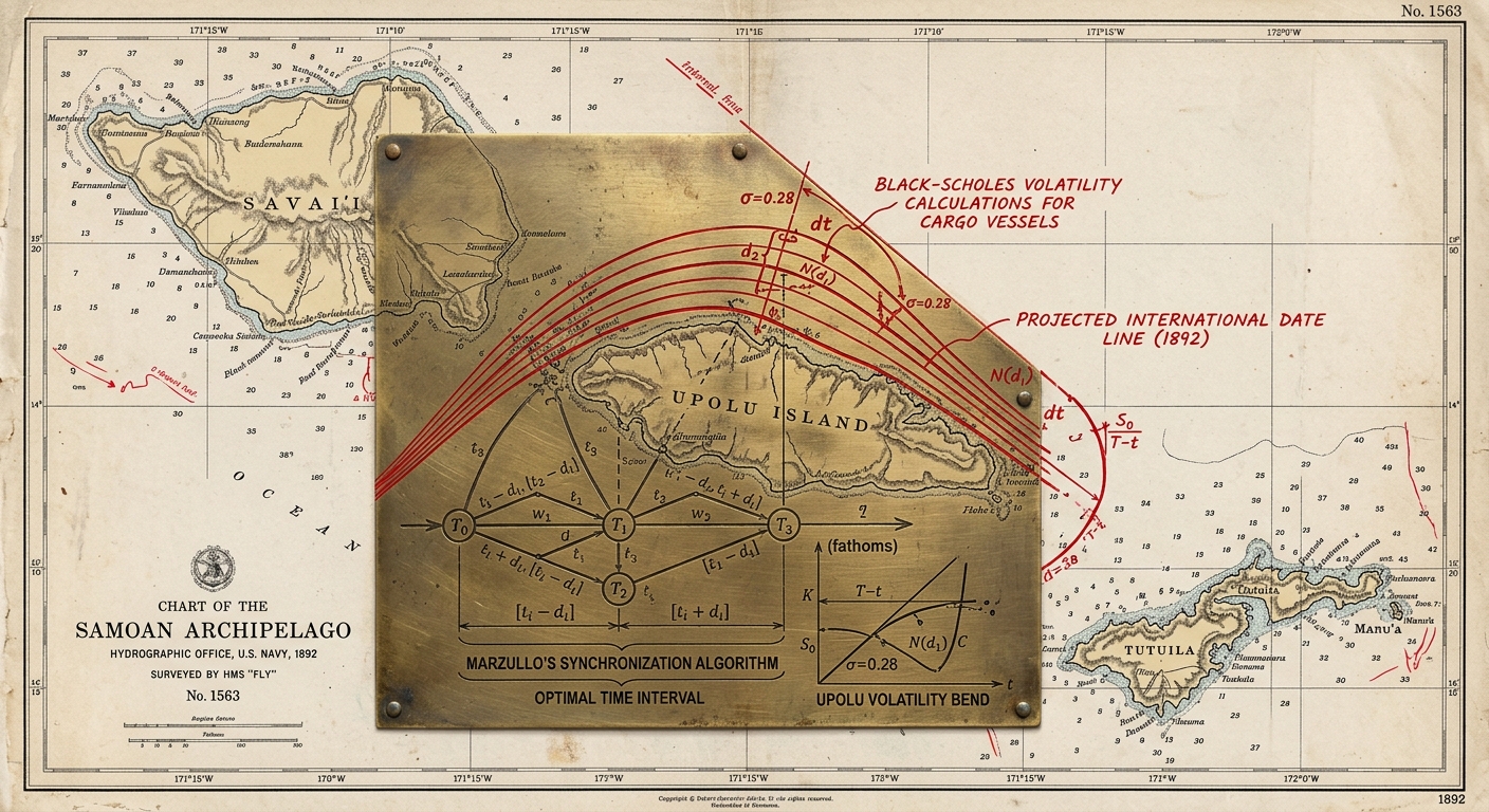
In 1892, Samoa shifted across the International Date Line to align trading days with the United States, effectively repeating the Fourth of July. This project approaches temporal borders as elastic fiscal infrastructures rather than astronomical standards. By intercepting live Automatic Identification System (AIS) telemetry from commercial ships in the Samoan corridor, the system calculates the cargo's economic weight using a Black-Scholes options pricing model. It then runs Marzullo's network synchronization algorithm across fleet timestamps to continuously locate the optimal longitudinal coordinate for the Date Line, physically rendering the temporal border as an unstable derivative of trade volume.
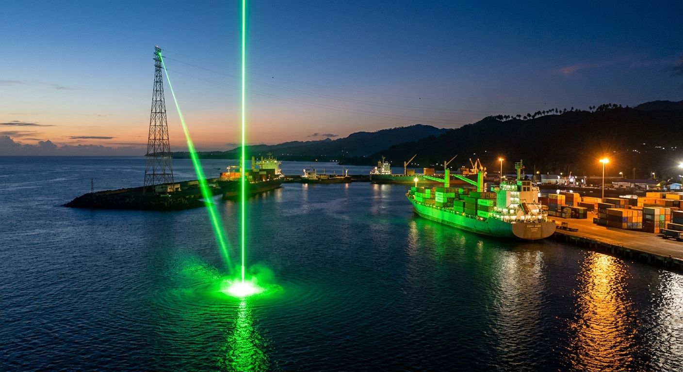
shown: Installed as a permanent coastal projection tower on the Mulinu'u Peninsula in Apia, Samoa, operating nightly across the exact bay where the 1892 time-shift decree was signed.
shown: Installed as a permanent coastal projection tower on the Mulinu'u Peninsula in Apia, Samoa, operating nightly across the exact bay where the 1892 time-shift decree was signed.
anchor facts used
- In 1845, the Philippines dropped Tuesday, December 31, 1844, to align with Asian trading partners instead of Mexico.
- In 1892, King Malietoa Laupepa of Samoa repeated Monday, July 4, shifting east of the Date Line to align with American trading vessels.
- These shifts were enacted locally in Apia, transforming the Date Line from a geographic absolute into a negotiated economic border.
mechanism
- Packet sniffing and telemetric data scraping — Harvesting physical ship velocities to establish the real-time weight of regional trade networks.
1. Intercepting live maritime Automatic Identification System (AIS) data from cargo vessels routing through the Samoa-Fiji corridor to calculate physical fleet velocity. - Black-Scholes derivative pricing model — Pricing the probabilistic value of 'tomorrow' versus 'today' based on the manifest cargo value of approaching fleets.
2. Calculating the economic gravity of approaching ships using a Black-Scholes option pricing model, treating the International Date Line as the strike price. - Marzullo's time synchronization algorithm (used in NTP servers) — Calculating the exact longitudinal spatial coordinate where the Date Line should theoretically bend to maximize fleet asset liquidity.
3. Running Marzullo's algorithm across the fleet's timestamps and economic weights to determine the optimal consensus geographic coordinate for the Date Line. - Geodetic laser ranging and bathymetric scanning — Manifesting the invisible economic temporal border as a physical, shifting barrier that vessels must pass through in the harbor.
4. Projecting this algorithmically optimized, dynamic meridian as a high-powered geodetic laser grid across the water at the historical 1892 boundary.
lineage
- "Standard Time" by Mark Formanek (2010) — Shifts the focus from human labor sustaining the illusion of time to algorithmic capital physically bending the concept of time.
- High-Frequency Trading Microwave Networks (McKay Brothers) — Adopts their latency-arbitrage logic but applies it geographically to macro-scale time zones and physical cargo.
- "The 2000 Year Old Computer" (Antikythera Mechanism research) by Freeth et al. — Contrasts ancient astronomical timekeeping with the purely economic, negotiated timekeeping of the colonial and modern Pacific.
curatorial qa (machine verdict, unedited)
SCORE 3/5 after 2 attempt(s)
READS: The harbor infrastructure links container trade to the cartographic artifact, which clearly diagrams the Marzullo algorithm and Black-Scholes curves over Samoan maritime geography.
FAILS: The laser projection on the water functions as a generic geometric grid rather than conveying real-time AIS data ingestion or algorithmic temporal recalculation.
READS: The harbor infrastructure links container trade to the cartographic artifact, which clearly diagrams the Marzullo algorithm and Black-Scholes curves over Samoan maritime geography.
FAILS: The laser projection on the water functions as a generic geometric grid rather than conveying real-time AIS data ingestion or algorithmic temporal recalculation.
spec: antigravity agent · keyframe/artifact: gemini-3.1-flash-image · video: veo-3.1 image-to-video · qa+wall text: gemini-3.7-flash watching the render · 36.9s total