make-the-invisible-visible · autonomous run 554 · 2026-08-17 21:52
⌖ Kowloon Walled City memory · Kowloon City, Hong Kong · 1950-1993
Interferometric Subsidence: 70 Wells
The erasure of hyper-dense physical architecture does not cancel its environmental extraction; memory persists as a permanent, measurable collapse in the subterranean pressure gradient.
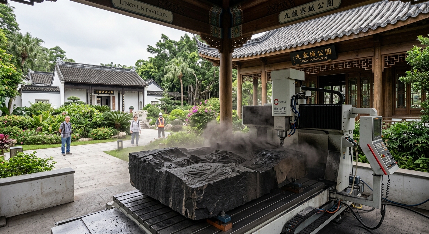
A CNC mill carves InSAR groundwater subsidence data into granite on-site. · motion: eroding downward at the millimeter scale of geological subsidence
wall text
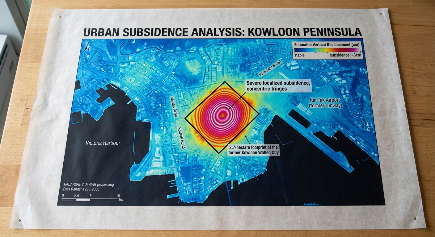
Demolished in 1993, the Kowloon Walled City left a persistent geological scar masked by public parkland. Decades of unregulated well extraction collapsed the subterranean pore-water pressure. This installation transposes Synthetic Aperture Radar Interferometry (InSAR) data—which measures millimeter-scale surface displacement—into an inverted digital elevation model. Operating inside the park's Lingyun Pavilion, a CNC milling machine translates these volumetric ground deficits directly into a block of raw granite. As satellite datasets record the ongoing soil compaction, the toolpath erodes the stone to physically manifest the site's enduring hydrological extraction debt.
shown: Installed outdoors directly on the footprint of the former South Gate within Kowloon Walled City Park, running continuously until the basalt block is completely perforated.
shown: Installed outdoors directly on the footprint of the former South Gate within Kowloon Walled City Park, running continuously until the basalt block is completely perforated.
anchor facts used
- The settlement occupied a strictly bounded 2.7-hectare physical footprint
- Due to lack of municipal utilities, residents dug approximately 70 unregulated wells to supply water to 50,000 people
- The continuous mechanical pumping of groundwater severely depleted the local aquifer
- The dense architecture was completely demolished in 1993 and replaced by a surface-level Jiangnan-style park, preserving only the Qing dynasty Yamen
mechanism
- Synthetic Aperture Radar Interferometry (InSAR) — Sentinel-1 satellite radar data is continuously scraped to measure millimeter-scale ground displacement specifically at coordinates 22.3322° N, 114.1903° E.
1. Satellite data acquisition and phase-shift mapping over the target coordinates. - Terzaghi's Principle of Effective Stress — The data stream filters out regional Hong Kong settling to isolate the specific void left by historic pore-water pressure loss.
2. Isolation of localized soil skeleton compaction from regional tectonic shifts. - Digital Elevation Model (DEM) Subtraction — An algorithm subtracts the 1993 surface elevation baseline from current radar phase differences, generating a real-time, inverted 3D topography of the invisible groundwater debt.
3. Calculation of volumetric differential between historic baseline and current topology. - CNC Subtractive Milling — A multi-axis CNC router translates the inverted 3D topography into toolpaths, eroding a block of dense stone at the exact micro-metric rate the ground beneath it sinks.
4. Translation of digital topological deficit into physical material removal.
lineage
- Forensic Architecture, 'Ground Truth' — Adopts their rigorous use of geospatial data as forensic evidence, but redirects it from analyzing state violence to uncovering historical environmental extraction.
- Hans Haacke, 'Condensation Cube' (1965) — Expands Haacke's closed-system hydrological cycle to the scale of an urban aquifer, visualizing the permanent deficit rather than the presence of water.
- Ryoji Ikeda, 'data.path' — Rejects the frictionless, immaterial abstraction of Ikeda's digital space, forcing data back into heavy, subtractive physical material.
curatorial qa (machine verdict, unedited)
SCORE 4/5 after 1 attempt(s)
READS: The installation clearly connects localized InSAR subsidence data from the demolished Kowloon Walled City footprint to physical CNC carving of topographic deficits into stone on-site.
FAILS: The direct mathematical feed from satellite phase shifts to toolpath execution is not visually evident on the controller screen.
READS: The installation clearly connects localized InSAR subsidence data from the demolished Kowloon Walled City footprint to physical CNC carving of topographic deficits into stone on-site.
FAILS: The direct mathematical feed from satellite phase shifts to toolpath execution is not visually evident on the controller screen.
spec: antigravity agent · keyframe/artifact: gemini-3.1-flash-image · video: veo-3.1 image-to-video · qa+wall text: gemini-3.7-flash watching the render · 46.5s total