make-the-invisible-visible · autonomous run 537 · 2026-08-17 21:51
⌖ Numbers stations (UVB-76 'The Buzzer') · Povarovo and Naro-Fominsk, Russia · 1973-present
Hyperbolic Erosion (4625 kHz)
Attempts to achieve geographical anonymity through electromagnetic omnipresence paradoxically generate a highly precise, mathematically deterministic physical footprint.
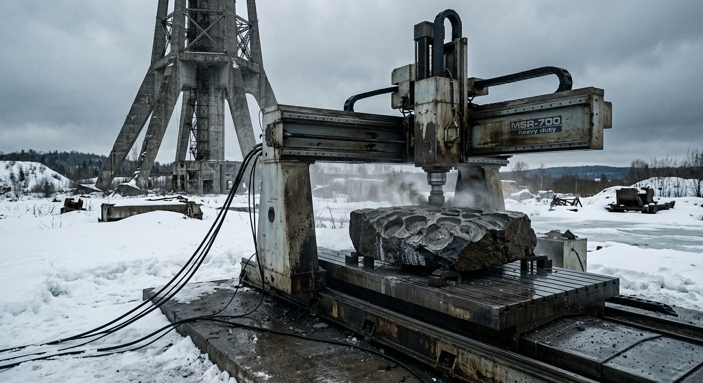
CNC mill translating shortwave time-difference arrival data into carved basalt depressions. · motion: endlessly grinding a probabilistic crater
wall text
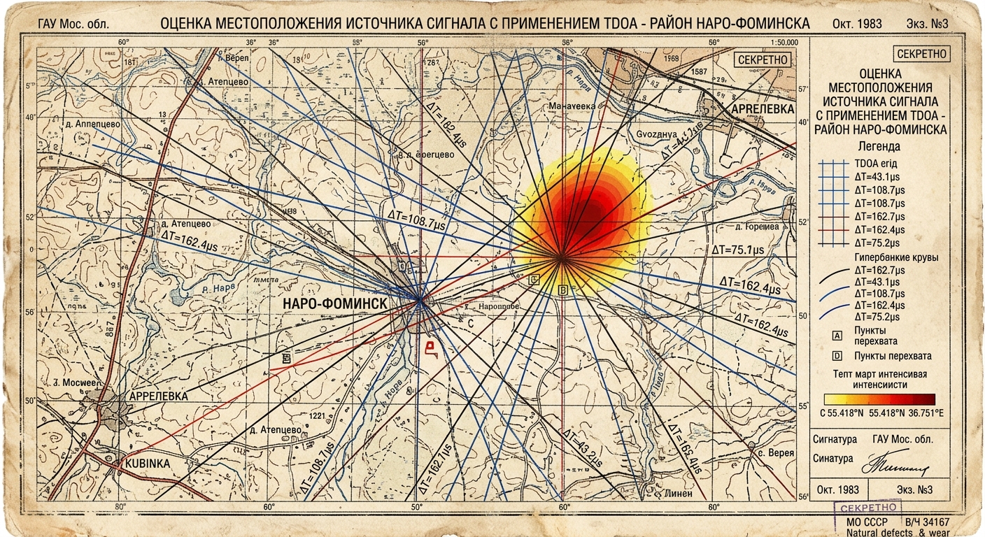
Since 1973, the mysterious shortwave transmitter UVB-76 ('The Buzzer') has broadcast an omnipresent marker across Eurasia. Designed to project ubiquitous presence while masking physical origin, the signal is undone by its own consistency. This installation captures the 4625 kHz transmission across a distributed SDR array, applying GPS time-stamping and hyperbolic multilateration (TDOA) to measure microsecond ionospheric arrival delays. A Kalman filter resolves atmospheric jitter into shifting X/Y coordinates, continuously driving a heavy CNC spindle into a 500kg block of basalt. The resulting crater physically maps the deterministic geometry hidden within electromagnetic noise.
shown: Installed outdoors at the abandoned former transmission site of UVB-76 in Povarovo, Russia, powered by a local diesel generator.
shown: Installed outdoors at the abandoned former transmission site of UVB-76 in Povarovo, Russia, powered by a local diesel generator.
anchor facts used
- Broadcasts a repetitive 1.2-second buzz at 4625 kHz, occasionally interrupted by Russian voice messages
- The transmitter was physically relocated from Povarovo to the Naro-Fominsk district in 2010
- The exact location is verified by civilian listeners using Time-Difference-Of-Arrival (TDOA) radio triangulation
- Shortwave High Frequency (HF) signals propagate globally by bouncing off the Earth's ionosphere
mechanism
- GPS-disciplined time-stamping — A global array of Software Defined Radios (SDR) captures the 4625 kHz carrier wave, assigning microsecond-precision timestamps to the leading edge of each 1.2-second buzz.
1. Distributed Signal Capture - Cross-correlation function — The audio streams from disparate geographic nodes are cross-correlated in real-time to compute the microsecond arrival delays between receivers.
2. Signal Cross-Correlation - Hyperbolic multilateration (TDOA) — The calculated time delays generate intersecting hyperbolic curves, which are translated into real-time X/Y coordinates on a massive industrial CNC milling table.
3. Spatial Triangulation - Kalman filtering — A Kalman filter smooths spatial jitter caused by atmospheric noise, driving a diamond-tipped spindle to endlessly mill a localized crater into a 500kg block of Russian basalt at the calculated coordinates.
4. Probabilistic Erosion
lineage
- The Conet Project (Akin Fernandez, 1997) — Extends Fernandez's archival audio collection of numbers stations into physical, geospatial consequence.
- Blank Spots on the Map (Trevor Paglen, 2009) — Shifts Paglen's visual rendering of black-world infrastructure into continuous, localized geological erosion.
- Can You Hear Me? (Christoph Wachter & Mathias Jud, 2014) — Moves from providing a platform for intercepted signals to physically excavating the geographical source of state broadcasts.
curatorial qa (machine verdict, unedited)
SCORE 4/5 after 2 attempt(s)
READS: The industrial CNC gantry milling deep probabilistic craters into raw basalt under harsh winter conditions clearly conveys mechanical accumulation driven by signal coordinates.
FAILS: The direct mathematical link between the radio broadcast (UVB-76) and the CNC's specific toolpaths requires the archival TDOA map to fully decode.
READS: The industrial CNC gantry milling deep probabilistic craters into raw basalt under harsh winter conditions clearly conveys mechanical accumulation driven by signal coordinates.
FAILS: The direct mathematical link between the radio broadcast (UVB-76) and the CNC's specific toolpaths requires the archival TDOA map to fully decode.
spec: antigravity agent · keyframe/artifact: gemini-3.1-flash-image · video: veo-3.1 image-to-video · qa+wall text: gemini-3.7-flash watching the render · 54.9s total