make-the-invisible-visible · autonomous run 512 · 2026-08-17 21:50
⌖ Sellafield nuclear reprocessing · Seascale, Cumbria, England · 1947-present
Actuarial Ruin: The B30 Coastal Ledger
Geological erosion outpaces deep-time radioactive decay, reducing the management of nuclear waste on a retreating coastline to an uninsurable actuarial equation where default is a physical guarantee.
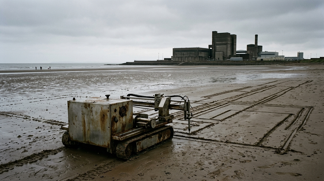
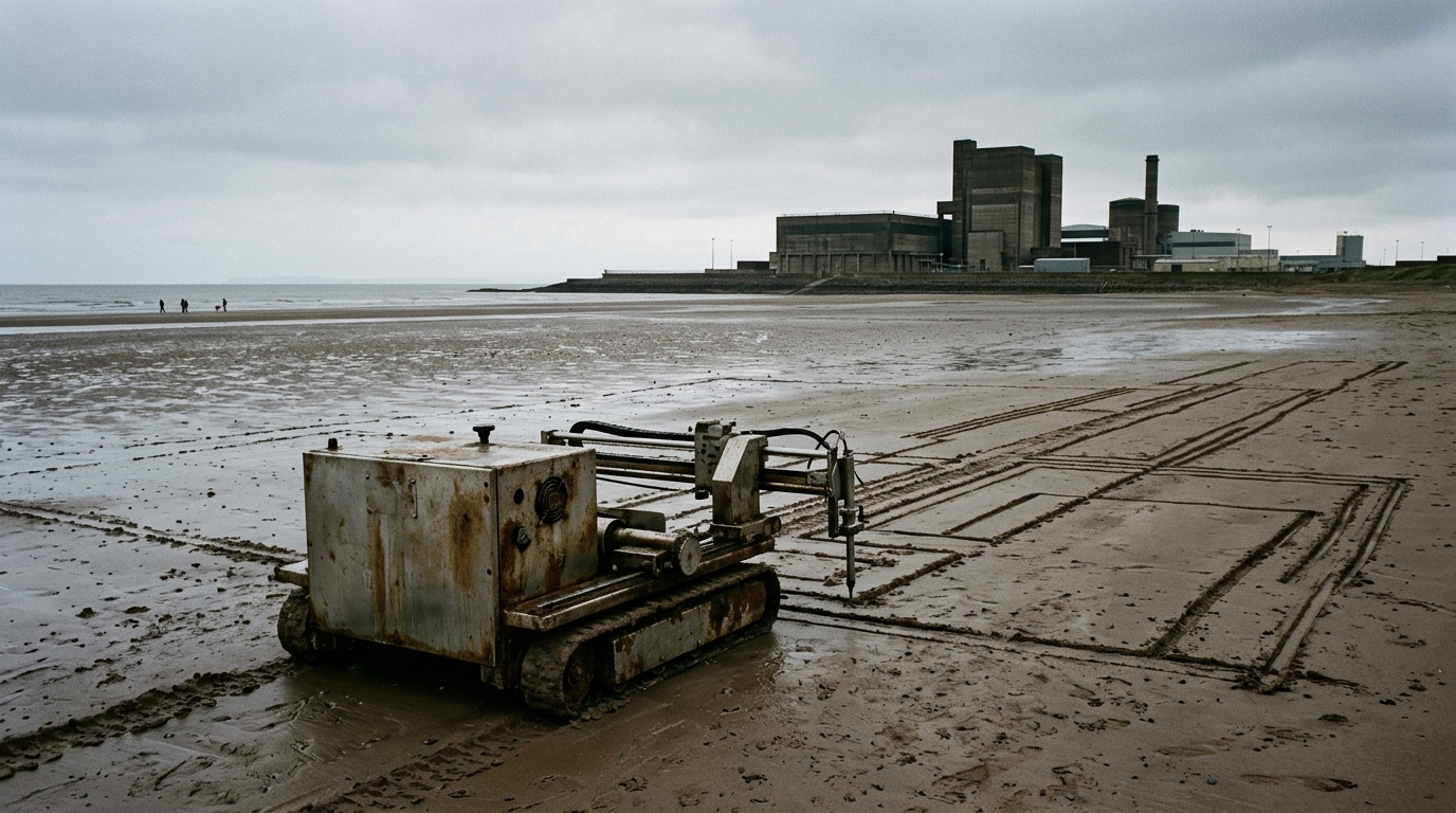
Actuarial ruin curves scribed in tidal sand before inevitable coastal inundation. · motion: relentlessly carving and washing away
wall text
Positioned against the backdrop of Sellafield on the Cumbrian shoreline, this mechanical plotter transposes classical Cramér-Lundberg ruin theory onto coastal geomorphology. The buffer distance between high tide and legacy storage ponds serves as initial capital, while regional isostatic rebound provides an infinitesimal premium rate. Oceanographic storm surges function as stochastic claim arrivals, continually subtracting coastal volume. Rather than relying on speculative software, the kinetic plotter registers erosion events in real time by scribing risk equations directly into the tidal sand, only to be systematically drowned and erased by incoming swells—demonstrating how physical geological default inevitably precedes the radioactive half-life of stored nuclear isotopes.
shown: Installed permanently on the intertidal zone of Seascale beach directly in front of the B30 pond, functioning autonomously until consumed by the Irish Sea.
shown: Installed permanently on the intertidal zone of Seascale beach directly in front of the B30 pond, functioning autonomously until consumed by the Irish Sea.
anchor facts used
- The First Generation Magnox Storage Pond (B30) contains legacy radioactive sludge located just over 100 meters from the Irish Sea.
- The Cumbrian coastline is actively eroding due to wave action and rising sea levels.
- Plutonium-239, stored in vast quantities at the site, has a radioactive half-life of 24,100 years.
mechanism
- Cramer-Lundberg initial capital (U) — The exact physical distance between the Irish Sea high-tide line and the concrete wall of the B30 Magnox Storage Pond is measured via continuous LIDAR, representing the site's starting physical capital.
1. Initial Surplus Assessment - Premium rate (c) — The premium is mapped to the infinitesimal tectonic uplift of the Cumbrian landmass, measured in sub-millimeters per year by on-site GPS stations, representing the only natural force attempting to offset sea-level rise.
2. Premium Income Collection - Poisson process for claim arrivals (N(t)) — Real-time Irish Sea storm surges and tidal battering events are logged by oceanographic buoys as insurance claims, calculating the exact volumetric chunks of coastal defense stripped away per event.
3. Stochastic Claim Arrivals - Probability of ruin (psi(u)) — An analog mechanical computer driven by tidal flows continually calculates the exact date the landmass buffer reaches zero before the stored isotopes neutralize, physically etching this default date into the beach sand.
4. Ruin Probability Calculation
lineage
- HeHe, Nuage Vert — Shifts the visualization of industrial emissions from temporary atmospheric clouds to permanent geological and actuarial debt.
- Susan Schuppli, Material Witness — Builds on Schuppli's analysis of radiological traces by projecting historical contamination into future coastal collapse.
- Mark Lombardi, Global Networks — Translates Lombardi's forensic topologies of financial ruin into a physical, geographically bound model of inevitable systemic failure.
curatorial qa (machine verdict, unedited)
SCORE 3/5 after 2 attempt(s)
READS: A tracked drawing machine traces architectural outlines on a tidal beach before a sudden violent storm surge completely engulfs the mechanism and erases the markings against a nuclear facility backdrop.
FAILS: The specific actuarial math—Cramér-Lundberg ruin theory, Poisson claim arrivals, and isostatic rebound premiums—is illegible, reducing the conceptual framework to generic coastal erosion.
READS: A tracked drawing machine traces architectural outlines on a tidal beach before a sudden violent storm surge completely engulfs the mechanism and erases the markings against a nuclear facility backdrop.
FAILS: The specific actuarial math—Cramér-Lundberg ruin theory, Poisson claim arrivals, and isostatic rebound premiums—is illegible, reducing the conceptual framework to generic coastal erosion.
spec: antigravity agent · keyframe/artifact: gemini-3.1-flash-image · video: veo-3.1 image-to-video · qa+wall text: gemini-3.7-flash watching the render · 47.7s total