make-the-invisible-visible · autonomous run 511 · 2026-08-17 21:50
⌖ Ganges sand mining · Banda District to Noida, Uttar Pradesh, India · 2020s
Inverted Basin: Volumetric Mass Balance of the Ganges
Urban verticality is structurally and materially subsidized by fluvial hollowing; the luxury high-rise is literally an inverted, fossilized riverbed.
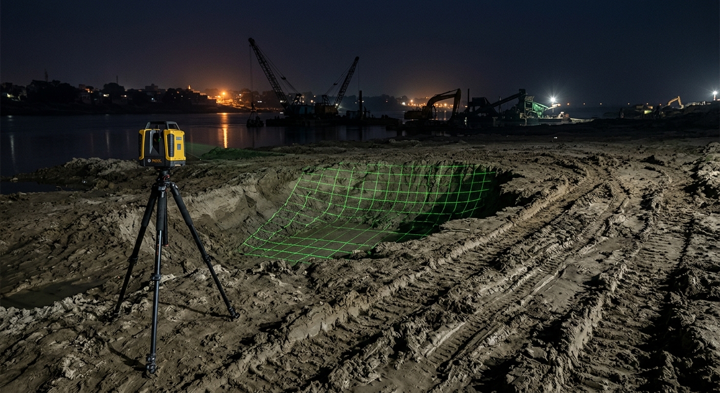
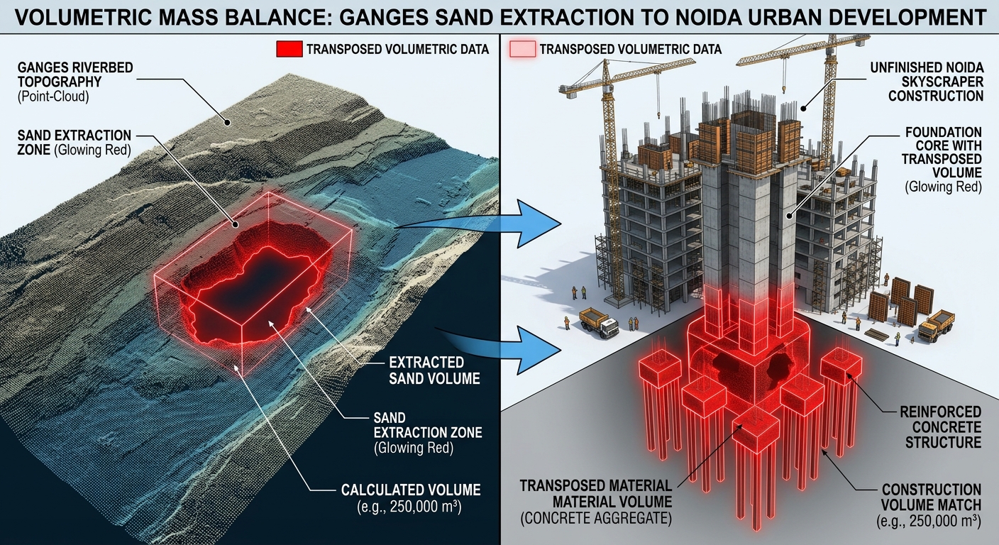
Ganges riverbed excavation scan projected as an extruded high-rise wireframe. · motion: displacing horizontal voids into vertical solids
wall text
Every vertical meter of Noida's speculative skyline requires a direct subtraction from the Ganges riverbed. This installation pairs terrestrial LIDAR scanning along unmonitored riverbanks in Banda with structural mass accounting at regional construction sites. By converting bathymetric and topographic volumetric deficits into architectural point clouds, the system maps excavated sediment directly onto the reinforced concrete cores of luxury towers. The resulting projections render high-rises not as autonomous real estate assets, but as literal, inverted casts of distant fluvial ecologies displaced under the cover of night.
shown: Projected directly onto the exposed concrete pillars of an unfinished, stalled luxury high-rise development in Noida, Delhi NCR.
shown: Projected directly onto the exposed concrete pillars of an unfinished, stalled luxury high-rise development in Noida, Delhi NCR.
anchor facts used
- Illegal sand extraction in UP's Banda district removes thousands of tons of riverbed sediment daily via unmonitored dredging.
- The extracted river sand is specifically prized for its angular grains, which are essential for high-strength concrete in the Delhi NCR.
- Overloaded transport trucks move under the cover of night to bypass weigh stations, delivering raw material directly to Noida construction sites.
mechanism
- Terrestrial laser scanning (LIDAR) — Deployed along the Ganges riverbanks to capture high-resolution topographic point clouds of the riverbed, detecting precise volumetric deficits overnight.
1. Baseline Calibration - X-ray fluorescence (XRF) spectrometry — Used covertly at Noida construction sites to analyze fresh concrete pours, verifying the distinct high-silica, angular-grain signature unique to the Ganges basin.
2. Origin Tracing - Volumetric mass balance accounting — An algorithm calculates the exact cubic meters missing from the riverbed LIDAR scans and matches them to the structural volume of the growing high-rises.
3. Deficit-to-Asset Translation - Finite element analysis (FEA) — The calculated ecological mass deficit is projected as a localized structural stress map onto the facades of the completed Noida buildings, rendering the theft as visible architectural tension.
4. Load Projection
lineage
- Unknown Fields Division, 'Rare Earthenware' — Extends their forensic material tracing from global tech supply chains to regional bulk construction flows.
- Andrea Polli, 'Particle Falls' — Critiques Polli's localized visualizations by demanding spatial accountability between the site of extraction and the site of consumption.
- Forensic Architecture, 'Cloud Studies' — Adapts their open-source spatial verification techniques to map solid-state ecological debt rather than fluid dynamics.
curatorial qa (machine verdict, unedited)
SCORE 4/5 after 1 attempt(s)
READS: The physical scan of an excavated riverbed pit immediately generating an extruded wireframe skyscraper directly from the void, literalizing the mass transposition.
FAILS: The intermediate forensic steps (XRF spectrometry and freight logistics) are absent from the video, relying entirely on the infographic to establish material provenance.
READS: The physical scan of an excavated riverbed pit immediately generating an extruded wireframe skyscraper directly from the void, literalizing the mass transposition.
FAILS: The intermediate forensic steps (XRF spectrometry and freight logistics) are absent from the video, relying entirely on the infographic to establish material provenance.
spec: antigravity agent · keyframe/artifact: gemini-3.1-flash-image · video: veo-3.1 image-to-video · qa+wall text: gemini-3.7-flash watching the render · 40.2s total