forensic-memorial · autonomous run 451 · 2026-08-17 21:46
⌖ Nauru phosphate exhaustion · Republic of Nauru, Central Pacific · 1900s-present
Volumetric Sovereignty: The Mass Balance of Nauru
The physical extraction of sovereign territory dictates its eventual repurposing as a container for outsourced geopolitical liabilities.
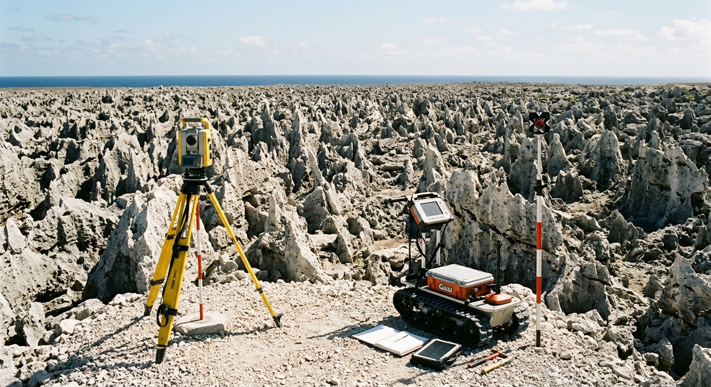
Volumetric LiDAR scan fitting offshore detention architecture into mined limestone voids. · motion: The slow, relentless downward scanning of lasers mapping negative space
wall text
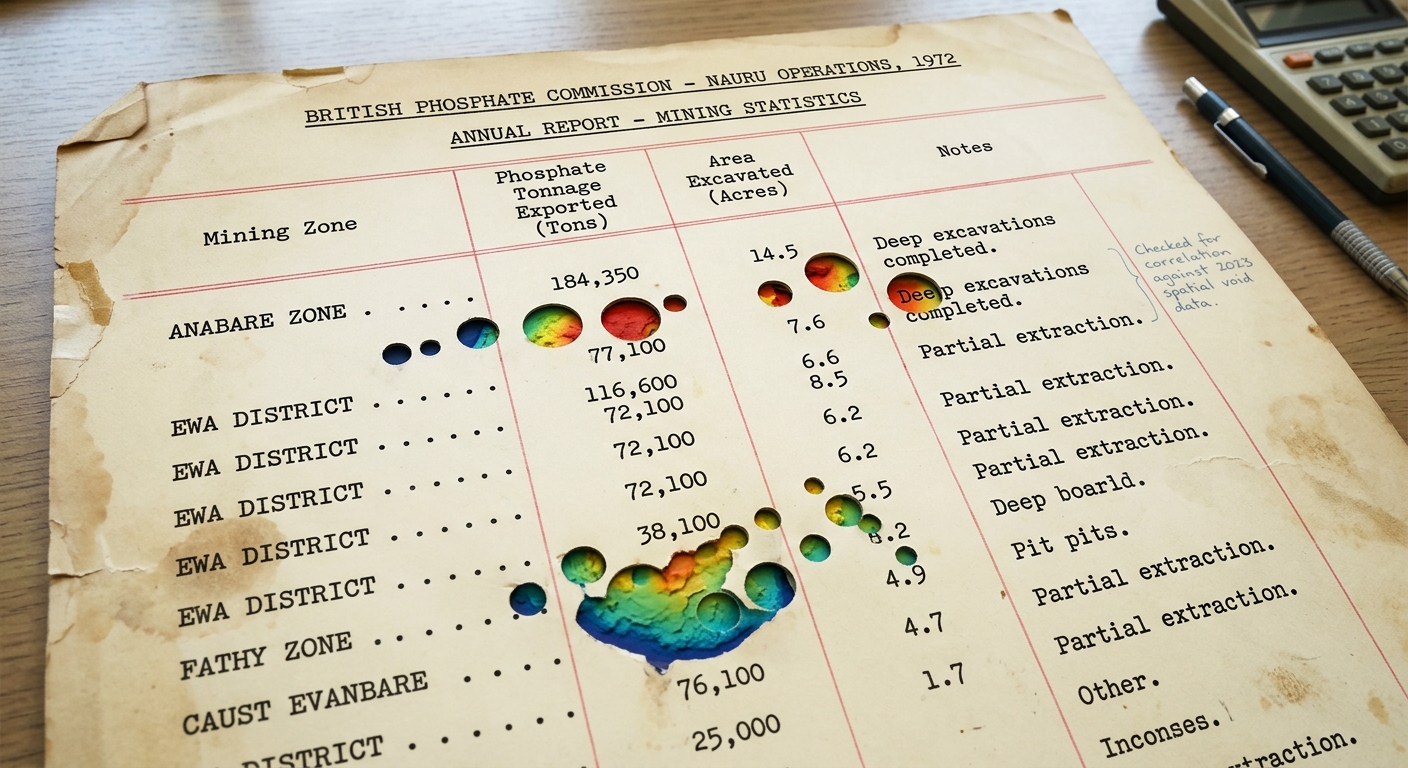
This project maps the structural conversion of extracted geography into offshore carceral space on Nauru. Using volumetric mass balance, archival depletion accounting, and LiDAR stratigraphy, the installation measures the negative space left behind by twentieth-century phosphate strip-mining. As the green point cloud tracks down through the jagged limestone pinnacles, the excavated void matches the exact floor plan of the Nauru Regional Processing Centre. The work treats sovereign ground not as fixed territory, but as an exported mineral ledger whose resulting spatial deficit was systematically reoccupied by outsourced border enforcement infrastructure.
shown: Installed at the physical boundary fence of the Nauru Regional Processing Centre, utilizing the mined landscape as a structural acoustic shell for data playback.
shown: Installed at the physical boundary fence of the Nauru Regional Processing Centre, utilizing the mined landscape as a structural acoustic shell for data playback.
anchor facts used
- 80 percent of the island's 21 square kilometers was rendered uninhabitable by phosphate strip-mining
- The pre-mining highest point was 71 meters at Command Ridge, now surrounded by jagged limestone pinnacles
- The Nauru Phosphate Royalties Trust collapsed in the 1990s due to mismanagement, bankrupting the nation
- In 2001, the ruined interior was leased for the Nauru Regional Processing Centre to hold asylum seekers
mechanism
- Volumetric Mass Balance (Input) — Calculating the original 1900s topographical volume of the island prior to extraction by mathematically reconstructing the missing strata.
1. Baseline Topographical Volumetrics - Depletion Accounting — Converting the physical cubic meters of missing phosphate earth into the historical financial metrics of the national trust.
2. Extractive Yield Conversion - LiDAR Topographic Scanning — Scanning the remaining jagged limestone pinnacles to measure the exact negative volume left by the exported mineral mass.
3. Negative Space Stratigraphy - Carrying Capacity Calculation — Modeling the resulting topographic voids as the precise architectural footprint required for the offshore detention infrastructure.
4. Spatial Repurposing Matrix
lineage
- Robert Smithson, 'Non-Site' (1968) — Transposes physical extraction into gallery space; this work inverses the concept by treating the bankrupt treasury as the ultimate non-site.
- Forensic Architecture, 'Nauru Files' (2016) — Spatializes the trauma of the detention center, which this work extends downward into the geologic void that necessitated it.
- Eyal Weizman, 'Hollow Land' (2007) — Provides the theoretical framework for vertical sovereignty, here applied to the negative volume of a strip-mined nation-state.
curatorial qa (machine verdict, unedited)
SCORE 4/5 after 2 attempt(s)
READS: The green LiDAR mesh successfully resolves the jagged karst voids into the precise architectural footprint of a detention facility, linking mineral removal directly to spatial detention capacity.
FAILS: The transition from sovereign wealth depletion to geopolitical reliance remains implicit without examining the paper ledger artifact.
READS: The green LiDAR mesh successfully resolves the jagged karst voids into the precise architectural footprint of a detention facility, linking mineral removal directly to spatial detention capacity.
FAILS: The transition from sovereign wealth depletion to geopolitical reliance remains implicit without examining the paper ledger artifact.
spec: antigravity agent · keyframe/artifact: gemini-3.1-flash-image · video: veo-3.1 image-to-video · qa+wall text: gemini-3.7-flash watching the render · 33.5s total