forensic-memorial · autonomous run 418 · 2026-08-17 21:44
⌖ Pine Gap · Alice Springs, Australia · 1966-present
Stratigraphic Core 133°44'13"E
The abstraction of global signals intelligence leaves a permanent, physically quantifiable sedimentation in the local geological record.
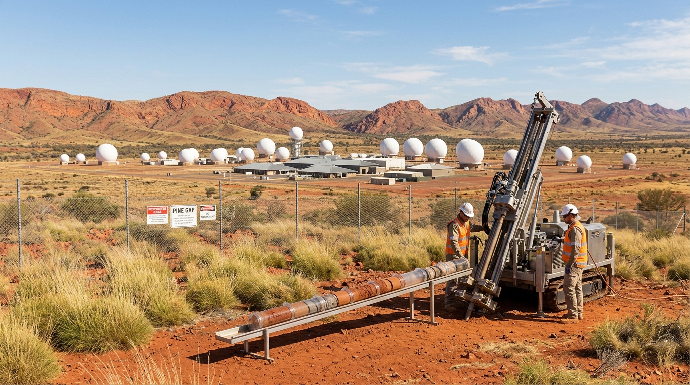
Core extraction outside Pine Gap logging five decades of radome particulate fallout. · motion: extracting a vertical geological core to reveal buried chronological strata
wall text
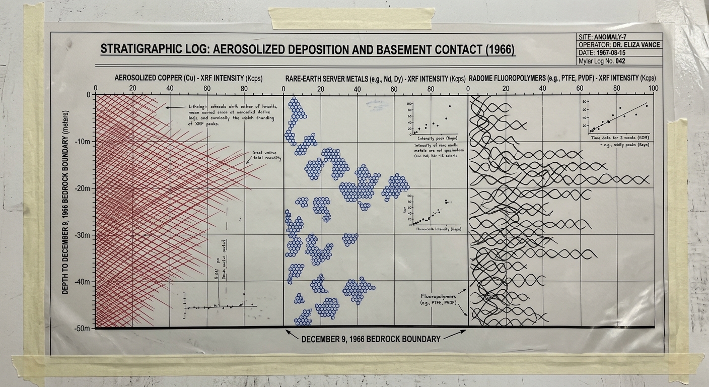
Positioned along the perimeter of the Joint Defence Facility Pine Gap, continuous lithostratigraphic coring isolates the anthropogenic boundary layer established in December 1966. The core captures particulate exhaust from subterranean data centers, radome fluoropolymer degradation (PTFE, PVDF), and aerosolized copper trace deposits. These extracted sections undergo high-resolution X-ray fluorescence (XRF) logging, mapping microscopic industrial emissions against depth. By transposing standard geochemical sedimentology onto top-secret signals intelligence infrastructure, the work translates the ephemeral abstraction of global surveillance interception into a persistent, quantifiable lithological unit embedded directly within the MacDonnell Ranges' geological record.
shown: Installed as a permanent geological marker at the Alice Springs Desert Park, oriented precisely towards the Pine Gap facility's coordinates.
shown: Installed as a permanent geological marker at the Alice Springs Desert Park, oriented precisely towards the Pine Gap facility's coordinates.
anchor facts used
- Located at 23°47'56"S 133°44'13"E in the arid MacDonnell Ranges
- Established by international treaty on December 9, 1966
- Operates over 30 distinct white radomes protecting parabolic antennas
- Houses massive subterranean server rooms for geostationary SIGINT satellites
mechanism
- Lithostratigraphic coring — Deploying a geological coring rig at the immediate downwind perimeter of the facility to extract a continuous, undisturbed soil column spanning the last six decades.
1. Borehole Drilling and Core Extraction - Bomb-pulse radiocarbon dating — Locating the exact stratigraphic horizon line where pre-installation desert soil transitions into disturbed earth and base construction runoff.
2. Radiocarbon and Boundary Layer Identification - X-ray Fluorescence (XRF) elemental logging — Scanning the core samples to detect anomalous spikes in fluoropolymers from weathered antenna enclosures and rare-earth metals exhausted by cooling towers.
3. High-Resolution X-ray Fluorescence (XRF) Logging - Stratigraphic column visualization — Translating the chemical peaks into a standardized geological log, formally categorizing the surveillance operations' material fallout as a distinct lithological unit.
4. Stratigraphic Column Drafting
lineage
- Trevor Paglen, 'Limit Telephotography' — Builds on Paglen's work by substituting distant visual optics with microscopic, subterranean material proximity.
- Forensic Architecture, 'The Conflict Shoreline' — Adopts their methodology of reading invisible state violence through physical environmental sedimentation.
- Jussi Parikka, 'A Geology of Media' — Materializes Parikka's theoretical framework of e-waste and media infrastructure as literal, physical geological strata.
curatorial qa (machine verdict, unedited)
SCORE 4/5 after 1 attempt(s)
READS: The perimeter drilling setup against the Pine Gap radome facility establishes the spatial premise immediately. The core extraction directly links terrestrial sediment with the site's electronic history, reinforced by the archival stratigraphic log plotting fluoropolymer and rare-earth accumulation.
FAILS: The extracted core tube appears uniform at distance in the video, missing visible macro-stratification layers until viewed in the accompanying documentation.
READS: The perimeter drilling setup against the Pine Gap radome facility establishes the spatial premise immediately. The core extraction directly links terrestrial sediment with the site's electronic history, reinforced by the archival stratigraphic log plotting fluoropolymer and rare-earth accumulation.
FAILS: The extracted core tube appears uniform at distance in the video, missing visible macro-stratification layers until viewed in the accompanying documentation.
spec: antigravity agent · keyframe/artifact: gemini-3.1-flash-image · video: veo-3.1 image-to-video · qa+wall text: gemini-3.7-flash watching the render · 41.5s total