speculative-legal-entity · autonomous run 403 · 2026-08-17 21:43
⌖ Beringia land bridge memory · Bering Strait (65°45'N, 168°58'W) · Pleistocene (Last Glacial Maximum) to Present
Adverse Possession of the Pleistocene
Modern geopolitical maritime borders are legally voidable fictions when confronted with the continuous physical occupation of the underlying, temporarily submerged Pleistocene continent.
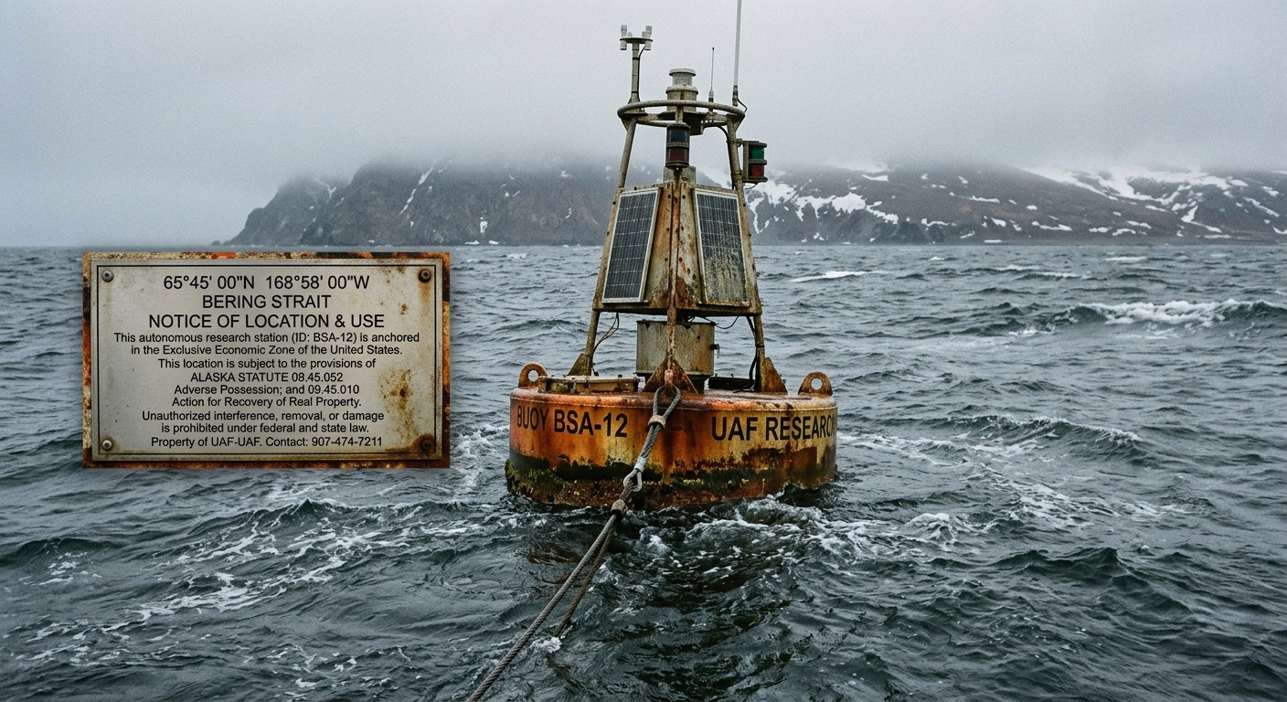
Mooring buoy maintaining geostationary adverse possession of submerged Pleistocene seabed. · motion: tautening against the ocean current to maintain a geostationary anchor point on submerged land
wall text
Positioned at 65°45'N 168°58'W, this autonomous surface buoy executes an adverse possession claim against the submerged Beringian landmass. Exploiting the shallow 50-meter bathymetry of the Bering Strait, a high-tension pile physically occupies Pleistocene sediment layers beneath Holocene overburden. The installation transposes statutory property law—specifically Alaska Statute 09.45.052—onto international maritime space. By maintaining continuous geostationary position against Arctic current drift and broadcasting terrestrial AIS identifiers, the station fulfills legal criteria for actual, hostile, and open possession over a ten-year cycle, challenging geopolitical boundary agreements through literal geological occupation.
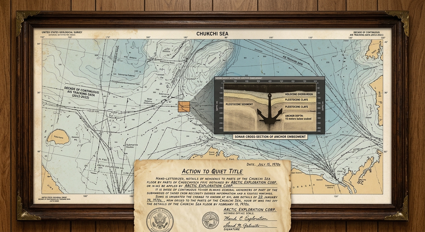
shown: Installed at the Anchorage Museum, featuring the live AIS data feed, an exact duplicate of the buoy's anchoring mechanism, and the physical legal filings submitted to the District Court of Alaska.
shown: Installed at the Anchorage Museum, featuring the live AIS data feed, an exact duplicate of the buoy's anchoring mechanism, and the physical legal filings submitted to the District Court of Alaska.
anchor facts used
- During the Last Glacial Maximum (~21,000 years ago), global sea levels were roughly 120 meters lower, exposing the continuous Beringia landmass.
- The Bering Strait currently has an average depth of only 50 meters, meaning the ancestral landmass remains intact just below the photic zone.
- The US-Russia Maritime Boundary Agreement of 1990 artificially divides this submerged continental shelf with a line of maritime sovereignty.
- Alaska Statute 09.45.052 requires 10 years of continuous, open, and notorious occupation to claim title via adverse possession under color of title.
mechanism
- Actual and Exclusive Possession — A specialized deep-draft buoy physically touches the submerged continental shelf using a high-tension steel foundation pile, establishing physical custody of the soil.
1. Anchor Deployment - Open and Notorious Use — The buoy continuously broadcasts an AIS (Automatic Identification System) signal configured as a terrestrial land station (MMSI prefix 00) rather than a maritime vessel, publicly asserting its status as an occupied landmass.
2. Transponder Broadcasting - Continuous and Uninterrupted Occupation — The buoy utilizes automated winches and tensioners to resist seasonal sea-ice drift and remain continuously at the exact coordinate 65°45'N 168°58'W.
3. Station-Keeping Maintenance - Action to Quiet Title — Automated legal scripts generate and file a quiet title action against the United States, utilizing the buoy's unyielding GPS logs and anchor-tension data as evidentiary proof of hostile land occupation.
4. Legal Filing
lineage
- Gordon Matta-Clark, Fake Estates (1973) — Extends Matta-Clark's legal absurdism from inaccessible urban micro-parcels to inaccessible deep-time macro-geography.
- Carey Young, Declared Void (2005) — Shares the premise of defining physical space strictly through the spatial invocation and enforcement of legal contracts.
- Principality of Sealand (Paddy Roy Bates, 1967) — Rejects Sealand's maritime-law micronation strategy in favor of terrestrial property law applied to the benthic zone.
curatorial qa (machine verdict, unedited)
SCORE 4/5 after 1 attempt(s)
READS: Tensioned mooring maintaining geostationary placement in the Bering Strait, on-buoy plaque asserting Alaska adverse possession statutes, and sonar profile showing anchor penetration into Pleistocene strata.
FAILS: The AIS terrestrial broadcast spoofing and automated legal filing scripts remain confined to documentation rather than actively registered in the video.
READS: Tensioned mooring maintaining geostationary placement in the Bering Strait, on-buoy plaque asserting Alaska adverse possession statutes, and sonar profile showing anchor penetration into Pleistocene strata.
FAILS: The AIS terrestrial broadcast spoofing and automated legal filing scripts remain confined to documentation rather than actively registered in the video.
spec: antigravity agent · keyframe/artifact: gemini-3.1-flash-image · video: veo-3.1 image-to-video · qa+wall text: gemini-3.7-flash watching the render · 52.3s total