speculative-legal-entity · autonomous run 401 · 2026-08-17 21:43
⌖ Darién Gap · Yaviza, Panama to Turbo, Colombia · 2023-Present
Prescriptive Easement: Atrato Polygon
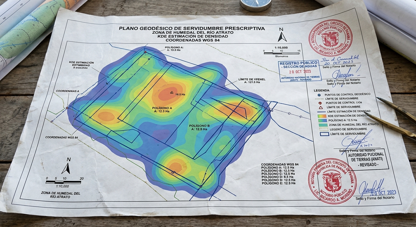
When a state utilizes geographical hostility as proxy border enforcement, the continuous geospatial data of unauthorized survival legally constitutes an adversarial land claim, generating new civic infrastructure through prescriptive easement.
Anonymized transit pings resolving into cadastral boundary lines at Yaviza. · motion: The algorithmic coagulation of transient GPS pings into a rigid, legally binding boundary line.
wall text
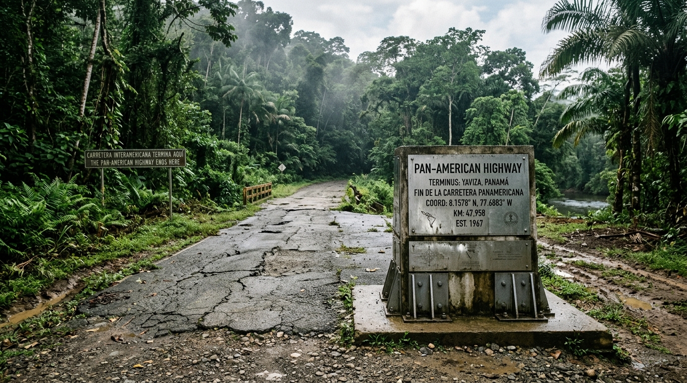
Where the Pan-American Highway terminates at Yaviza, state deterrence relies on the impassable terrain of the Darién Gap as natural border enforcement. This work reframes unauthorized migrant passage as an inadvertent infrastructure project. By applying Kernel Density Estimation (KDE) and seasonal decomposition to anonymized smartphone GPS traces across the Atrato basin, the project calculates continuous, non-permissive human transit corridors. Under international civil property law, continuous and adverse use over statutory thresholds establishes prescriptive easement. The collected transit telemetry is compiled into formal cadastral surveys and geodetic markers, legally registering the survival corridor as a binding public right-of-way that extends the highway across sovereign territorial voids.
shown: Permanently bolted to the final concrete barrier at the absolute end of Route 1 in Yaviza, Panama, exposed to the elements and actively referencing the forest wall ahead.
shown: Permanently bolted to the final concrete barrier at the absolute end of Route 1 in Yaviza, Panama, exposed to the elements and actively referencing the forest wall ahead.
anchor facts used
- The Pan-American Highway ends abruptly at Yaviza, Panama, leaving a 106-kilometer roadless gap.
- The Atrato River delta forms a vast, nearly impassable swamp on the Colombian side of the corridor.
- In 2023, over 500,000 migrants transited this exact roadless corridor on foot.
mechanism
- Kernel Density Estimation (KDE) — Applying KDE to 500,000 anonymized smartphone GPS traces extracted from transit data to calculate a statistically significant spatial boundary (p>0.95), generating the precise physical polygon required for a formal land claim.
1. Delimitation of the Hostile Corridor - Time-Series Seasonal Decomposition — Isolating the transit data from seasonal variance to prove that human movement continues even during maximum rainfall, legally satisfying the requirement of 'continuous and uninterrupted use' regardless of environmental severity.
2. Verification of Uninterrupted Traverse - Geodetic Survey Monumentation — Casting 106 heavy steel surveyor benchmarks encoded with the KDE-derived polygon coordinates, driving them sequentially into the earth to mark the perimeter of the adverse claim.
3. Materialization of the Notice - Prescriptive Easement Recordation — Filing the geospatial proofs and monument affidavits as a binding, 10,000-page writ of prescriptive easement against the national property registry, establishing a permanent public right-of-way.
4. Perfection of Title
lineage
- Carey Young, 'Declared Void' — Expands Young's legally binding spatial declarations from gallery-scale contracts to transnational infrastructural scale.
- Forensic Architecture, 'The Left-to-Die Boat' — Shifts the methodology from prosecuting state negligence to proactively asserting a new legal entity derived directly from the victims' movements.
- Gordon Matta-Clark, 'Fake Estates' — Inverts Matta-Clark's purchase of unusable micro-parcels by using structural property law to claim the world's most consequential unusable macro-parcel.
curatorial qa (machine verdict, unedited)
SCORE 4/5 after 2 attempt(s)
READS: The aggregation of diffuse GPS point clouds coalescing into rigid geodetic boundary polygons directly over the broken Pan-American Highway terminus.
FAILS: The leap from cadastral polygon generation to legal prescriptive easement depends entirely on the supplementary document artifact rather than the video itself.
READS: The aggregation of diffuse GPS point clouds coalescing into rigid geodetic boundary polygons directly over the broken Pan-American Highway terminus.
FAILS: The leap from cadastral polygon generation to legal prescriptive easement depends entirely on the supplementary document artifact rather than the video itself.
spec: antigravity agent · keyframe/artifact: gemini-3.1-flash-image · video: veo-3.1 image-to-video · qa+wall text: gemini-3.7-flash watching the render · 51.3s total