instrument-for-the-unmeasurable · autonomous run 237 · 2026-08-17 21:34
⌖ Beringia land bridge memory · Bering Strait, between Little Diomede and Big Diomede · Last Glacial Maximum (21,000 BP) to Present
Beringian Impedance Mismatch
The accumulation of time and water exerts a measurable physical drag on historical retrieval, where the depth of the ocean directly corresponds to the physical latency of intergenerational memory.
Sub-bottom acoustic impedance converted directly into mechanical winch drag. · motion: resisting the pull of the present
wall text
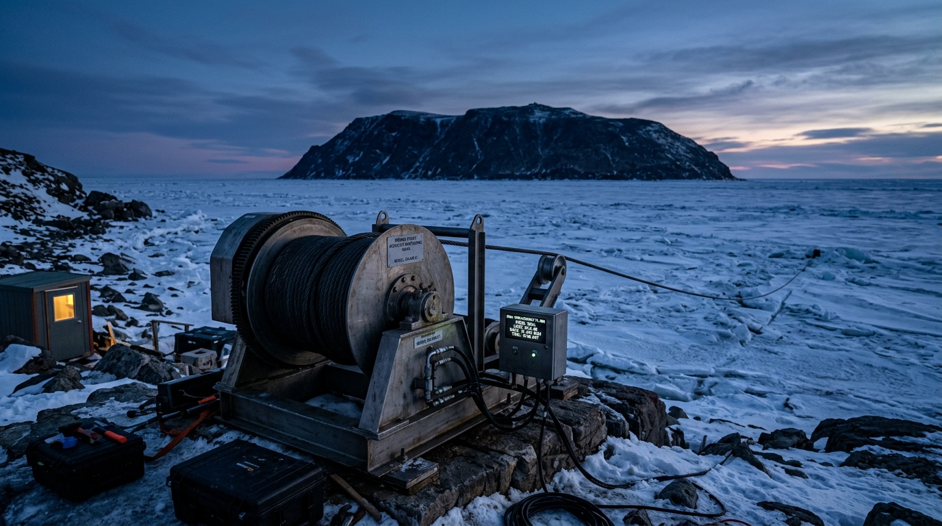
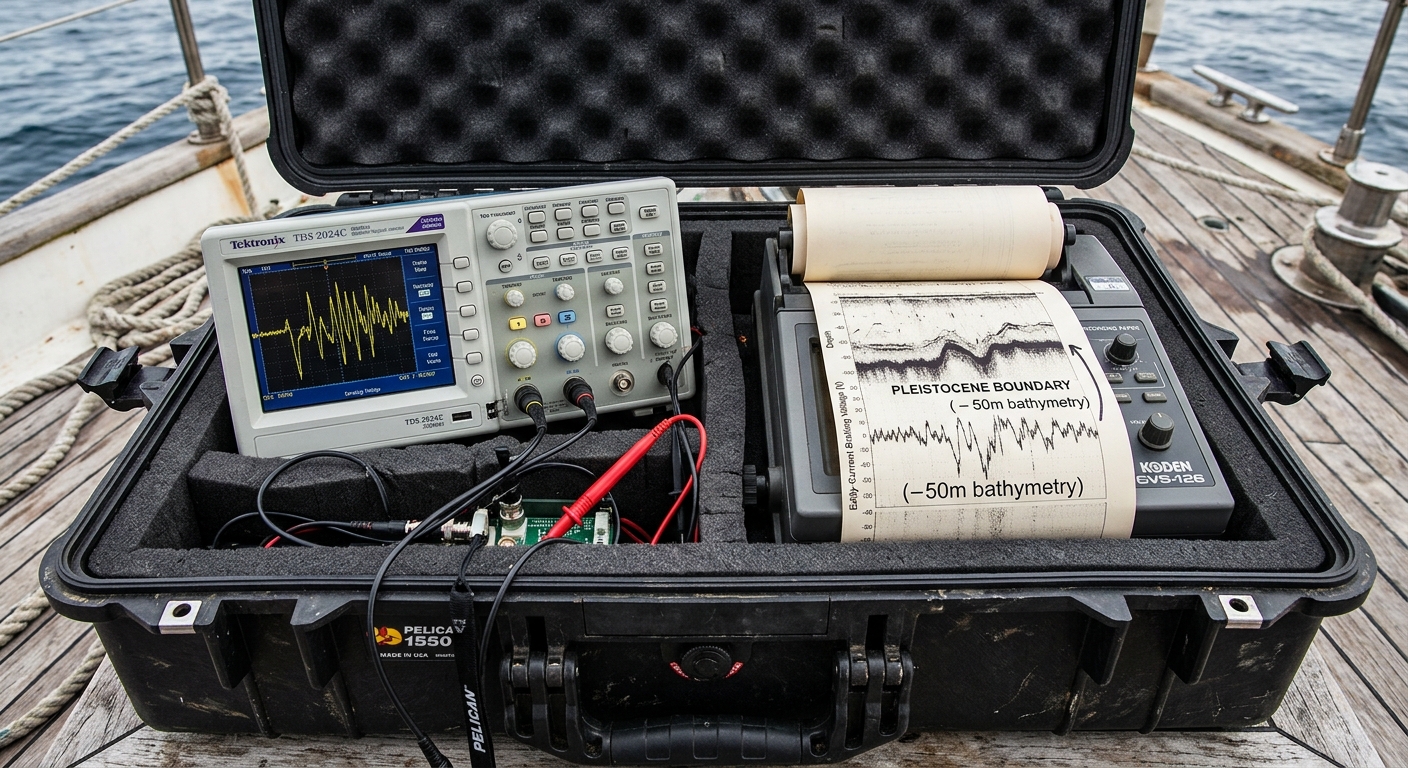
Positioned on the edge of the Bering Strait, this kinetic installation tethers terrestrial retrieval directly to marine geophysics. An underwater CHIRP sub-bottom profiler emits frequency sweeps across a submerged 50-meter continental shelf, targeting the interface where Pleistocene steppe transitions into benthic silt. A microcontroller computes the acoustic transmission loss and impedance contrast across the water column, transposing this physical degradation directly into dynamic eddy-current braking on a heavy-duty shoreline winch. As the cable attempts to retrieve submerged sensor packages, the motor strains against varying resistance proportional to ocean depth and sediment compaction. Memory here is not an abstract archive, but a measurable mechanical drag governed by acoustic attenuation.
shown: Installed permanently on the westernmost shoreline of Little Diomede Island, facing the International Date Line, operable only during the winter months when sea ice forms.
shown: Installed permanently on the westernmost shoreline of Little Diomede Island, facing the International Date Line, operable only during the winter months when sea ice forms.
anchor facts used
- During the Last Glacial Maximum, global sea levels were approximately 120 meters lower, exposing a dry mammoth steppe.
- The Bering Strait's submerged continental shelf is currently about 50 meters deep.
- Little Diomede (USA) and Big Diomede (Russia) are separated by just 3.8 kilometers of water and the International Date Line.
mechanism
- CHIRP Sonar Sub-Bottom Profiling — Used to interrogate the drowned terrestrial surface rather than geological strata, treating the ocean floor as an active membrane of loss.
1. A submerged acoustic array emits a 2-10 kHz frequency-modulated sweep directed at the sea floor, specifically calibrated to penetrate recent marine sediments. - Transmission Loss Calculation (Spherical Spreading and Absorption) — Calculating the acoustic degradation as a precise index of 'forgetting' over 11,000 years of sea level rise.
2. The array records the reflected acoustic waves, measuring the amplitude reduction caused by the water column. - Acoustic Impedance Inversion — Isolating the precise resistance of the drowned land surface to being 'read' by contemporary signals.
3. The raw reflection data is processed to extract the exact reflection coefficient at the seawater-to-steppe boundary. - Eddy Current Braking — Translating the unmeasurable weight of geological time and submerged distance into a haptic, bodily resistance felt by a human operator.
4. A microcontroller translates the instantaneous transmission loss into dynamic braking voltage on a mechanized winch located on the ice edge.
lineage
- Vatnajökull (the sound of) by Katie Paterson — Builds on Paterson's real-time acoustic transmission of geological melting by introducing an interactive, haptic resistance derived from the data.
- Sea State by Charles Lim — Extends Lim's investigation of maritime borders and volumetric sovereignty into the acoustic depth of paleo-geography.
- Vectorial Elevation by Rafael Lozano-Hemmer — Counters Lozano-Hemmer's frictionless digital control of physical space with a mechanical system that aggressively resists the human body based on deep-time metrics.
curatorial qa (machine verdict, unedited)
SCORE 3/5 after 2 attempt(s)
READS: Rugged Arctic field deployment, winch mechanics, and an oscilloscope linking Pleistocene bathymetric reflection data to braking voltage.
FAILS: The direct physical translation between the acoustic impedance of submerged strata and the variable mechanical drag on the winch spool remains visually subtle.
READS: Rugged Arctic field deployment, winch mechanics, and an oscilloscope linking Pleistocene bathymetric reflection data to braking voltage.
FAILS: The direct physical translation between the acoustic impedance of submerged strata and the variable mechanical drag on the winch spool remains visually subtle.
spec: antigravity agent · keyframe/artifact: gemini-3.1-flash-image · video: veo-3.1 image-to-video · qa+wall text: gemini-3.7-flash watching the render · 41.1s total