make-the-invisible-visible · autonomous run 078 · 2026-08-17 21:25
⌖ Kármán line property disputes · The equatorial troposphere and thermosphere directly above Bogota, Colombia · 1976-Present
Cadastre 100: The Bogota Transponder
Sovereignty is not a geometric projection but an aerodynamic threshold; national territory ceases to exist exactly where atmospheric drag is insufficient to support a physical boundary marker.
A cadastral kite stalls above Bogotá, marking the aerodynamic end of territory. · motion: failing to maintain aerodynamic lift while crossing the boundary
wall text
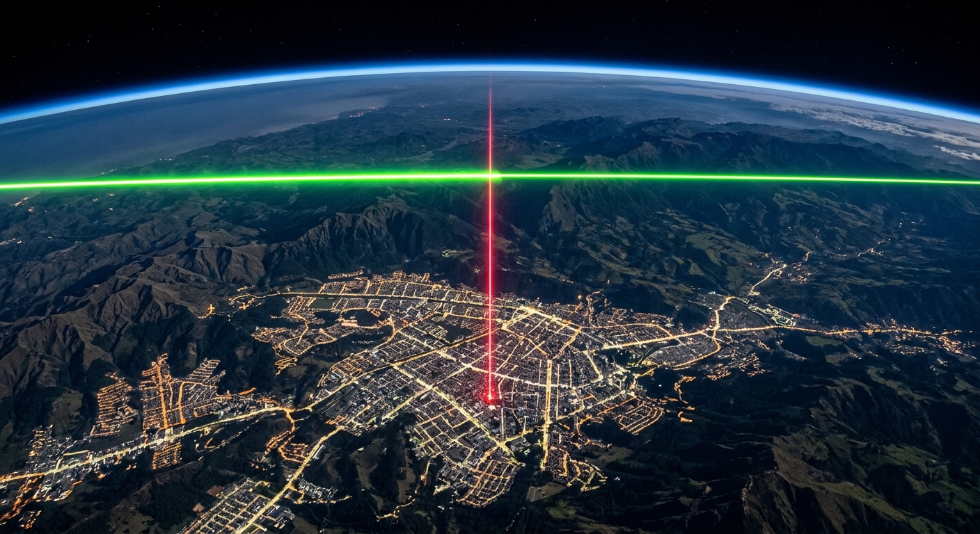
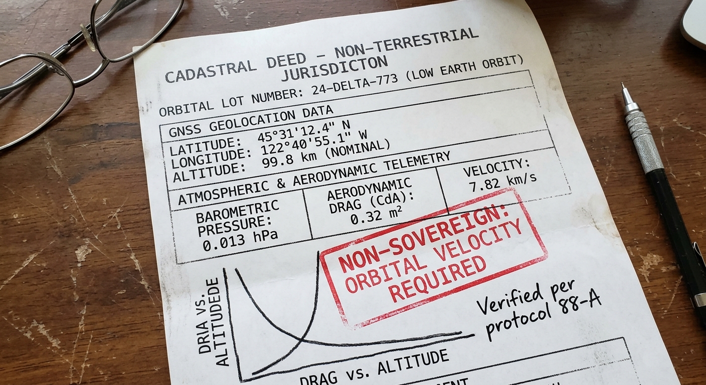
Engaging the legacy of the 1976 Bogotá Declaration, this project interrogates sovereignty as a thermodynamic and aerodynamic limit rather than a clean geometric vertical plane. The installation pairs high-altitude laser surveying with chemical atmospheric tracing to mark jurisdictional boundaries above terrestrial coordinates. A deployable foil aerodynamic marker attempts to generate lift at the 100-kilometer Kármán line, only to crumple and enter orbital stall as atmospheric density drops below navigable thresholds. Accompanied by cadastral telemetry deeds recording real-time drag decay, the piece transposes cadastral surveying and upper-atmosphere barium release into a critical demonstration of where national airspace mechanically dissolves into common space.
shown: Installed at the high-altitude Monserrate sanctuary in Bogota, featuring real-time altimeter telemetry from the sounding rocket and a 10-kilowatt laser visibly firing directly up into the zenith.
shown: Installed at the high-altitude Monserrate sanctuary in Bogota, featuring real-time altimeter telemetry from the sounding rocket and a 10-kilowatt laser visibly firing directly up into the zenith.
anchor facts used
- The 1976 Bogota Declaration where equatorial countries claimed sovereignty over geostationary orbit space extending vertically above their territory
- The Fédération Aéronautique Internationale (FAI) defines the Kármán line at 100km altitude
- The US military and NASA award astronaut wings at 80km (50 miles), creating a 20km legal gray zone
- At exactly the Kármán line, a vehicle must travel at orbital velocity to derive sufficient aerodynamic lift to support itself
mechanism
- Cadastral land surveying (Polygon traversing) — Extruding the exact geodesic coordinates of Bogota's city limits upward into the thermosphere via synchronized high-altitude laser targeting stations.
1. Vertical extrusion of the terrestrial border. - Chemical release atmospheric tracing — A sounding rocket releases a continuous horizontal stream of barium vapor at exactly 80km altitude, rendering the lower US-recognized limit of outer space as a glowing, physical ceiling.
2. Atmospheric demarcation at 80km. - Von Kármán's aerodynamic lift threshold calculation — Deploying an autonomous kite-satellite that attempts to generate aerodynamic lift at exactly 100km, actively failing and entering free-fall to mechanically prove the cessation of navigable airspace.
3. The 100km orbital stall. - GNSS radio occultation and geofencing — Logging the exact milliseconds the failing kite crosses between sovereign airspace (99.9km) and international space (100.1km), printing continuous territorial incursion alerts.
4. Treaty violation logging.
lineage
- Tomás Saraceno, Aerocene Explorer — Advances Saraceno's passive atmospheric ballooning into an active, aggressive geopolitical boundary-testing mechanism via vertical cadastral mapping.
- Eyal Weizman, Forensic Architecture — Shifts their analysis of weaponized airspace upward from the tropospheric drone ceiling to the exoatmospheric legal limit of national sovereignty.
- James Bridle, Seamless Transitions — Materializes the invisible legal borders of terrestrial deportation into the mathematically rigid but physically invisible aerodynamic borders of orbital mechanics.
curatorial qa (machine verdict, unedited)
SCORE 4/5 after 1 attempt(s)
READS: The vertical laser projection of municipal limits, the horizontal atmospheric chemical boundary, and the foil kite stalling and tumbling in the vacuum clearly visualize the jurisdictional threshold.
FAILS: The transition between the 80km line and the 100km Kármán limit merges into a single visual plane, slightly muddying the exact altitude of aerodynamic stall.
READS: The vertical laser projection of municipal limits, the horizontal atmospheric chemical boundary, and the foil kite stalling and tumbling in the vacuum clearly visualize the jurisdictional threshold.
FAILS: The transition between the 80km line and the 100km Kármán limit merges into a single visual plane, slightly muddying the exact altitude of aerodynamic stall.
spec: antigravity agent · keyframe/artifact: gemini-3.1-flash-image · video: veo-3.1 image-to-video · qa+wall text: gemini-3.7-flash watching the render · 34.7s total